Pics from the thread are all available in my Flickr set from the hike:
http://www.flickr.com/photos/krobins...7601247455783/
Feel free to post your own hiking/climbing/outdoors trip reports or whatever hiking-related questions you have here if theres any interest in this eventually Ill post some sort of Ask a Thru-hiker thread for anyone considering doing a long-distance hike in the future in 2001, I hiked about 2000 miles of the Pacific Crest Trail and have helped two friends plan similar hikes since then. Anyway.
For those who dont know, the Enchantment Lakes in the Alpine Lakes Wilderness are some of the most pristine backcountry that are even remotely accessible, and have an amazing reputation amongst hikers. Permits are required to hike in them from June 15-October 15th, and they can actually be quite hard to secure. Fortunately, a good friend of my recently got admitted into law school in Davis, CA, and mentioned to me that he wouldnt be able to use the passes allotted to him for Thursday the 2nd through Sunday the 5th.
Kate and I have attempted to hike the Enchantments two times previously once in late June and once in early September and both times were thwarted by the weather. Much of the trail, once you get past Snow Lake and climb into the lower enchantment lakes, is located on exposed granite ledges (some areas have had rebar drilled into them in some spots because of the exposure and the 1500+ft falls if you miss a step). Its not entry-level hiking and, like I was saying, the first time we attempted it, we hiked up in a year with relatively high snowpack, and by the time we reached the first lake (elevation 6800), despite temperatures of 95+ on the hike along the way up, there was 3+ft of snow still on the exposed granite ledges. Without ice axes and ropes, we descended back to Snow Lake and spent a few days relaxing there. It was still a fun hike (I was a beginning hiker at the time) but I really wanted to see the upper enchantments. We came back two years ago and tried the hike at the end of August/early September. The weather on the way up (the trailhead is at 1400ft, with Snow Lake at 5400ft and the first of the Enchantment Lakes at 6800ft) was pleasant 85 and sunny. By the time we got to Snow Lake, 7 hours later, it had turned cloudy and was beginning to rain. Over the next day the conditions rapidly deteriorated into a massive storm, and our attempt to climb the exposed ledges beyond Viviane were deterred by a blizzard with 15-foot visibility. Lame.
Fast-forward to this year. Were determined, and even though were ultralight hikers for the most part (my packs base weight before food and water normally weighs 10lb), I decided to pack up some extra equipment a Canon 30D that I just got and a few lenses. The weather was phenomenal, and we covered ground quickly we had picked up the permits from the Rangers station by 7:50AM (they open at 7:45) and were on the trail at 8:30. Climbing quickly to avoid the heat (at the lower elevations its regularly 90+ and climbing steep and unshaded slopes isnt exactly my idea of fun in that kind of heat). We stopped at Snow Creek to filter some water, waiting around just long enough for me to take my first attempt at time-lapse photography on the new camera.
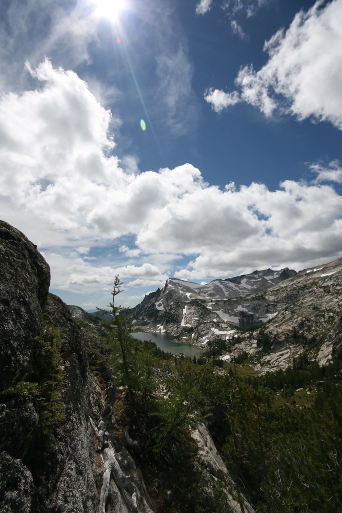
15 minutes later, we were back on the trail, pushing to get through as much of the early climbing as possible. The trail is fairly jarring the whole way, but its really at its worst in the first 4-5 miles. Its still a beautiful hike, but when youve seen it, and only it, several times over, its a bit . . . tiresome. Anyway. We climbed the first 6.5 miles, gaining about 4000 feet in elevation, by 12:30. Normally a 6.5 mile hike isnt much, but we were drained by the time we hit Snow Lake. Still, with a goal of at least camping at Lake Viviane (only a little over a mile further, but 1400ft of elevation higher for a steep-ass climb), and ample mosquitoes at the lower, warmer lake, we pushed on. We hit Viviane and pushed ourselves past the rebar steps (
http://www.flickr.com/photos/niffgurd/227990195/ -- photo not mine), eventually settling at Sprite Lake a little ways further in. Overall progress for the day just under 10 miles and just over 6000ft of total elevation gain. Ouch. Thank you, Aleve.
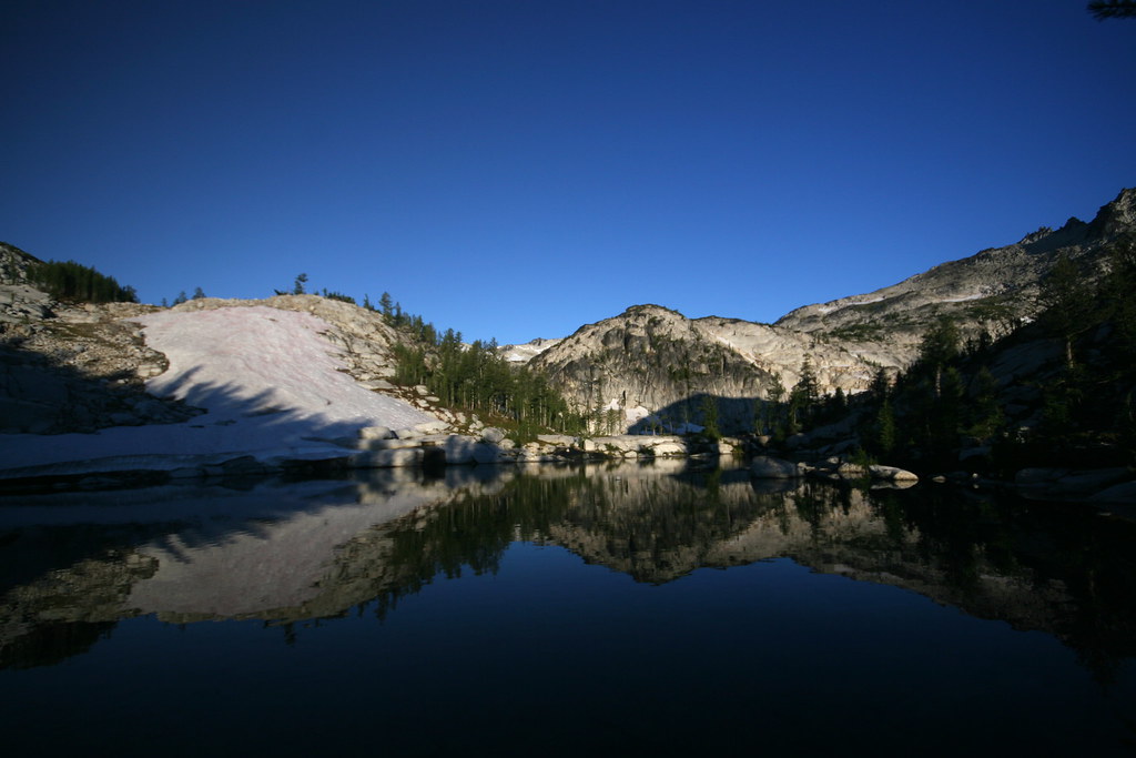
Our campsite was perfect. I could spent the rest of eternity here and never want for anything, I think. Heres a pic from a few feet away from our tent, taken at sunrise on day three.
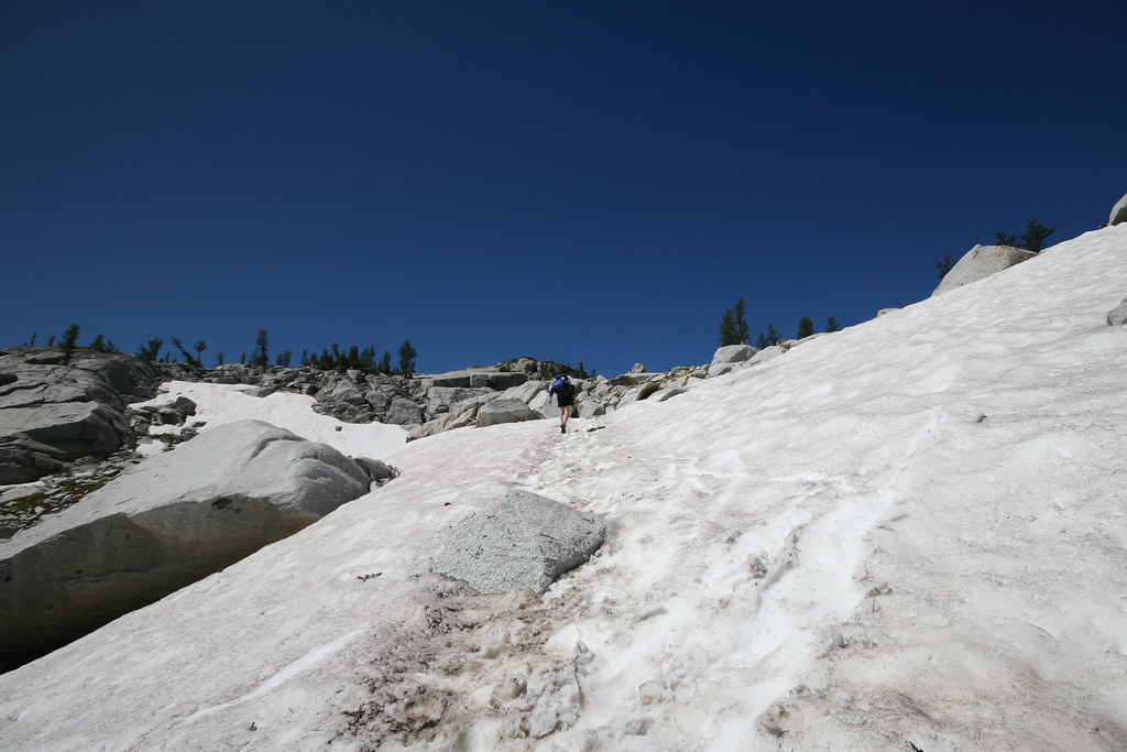
For most of day two, we wandered throughout the Upper Enchantment basin. We were camped in the lower enchantments, which are a bit less rugged and exposed than their upper brethren. The climb to it wasnt nearly as strenuous, and we were able to relax for the most part there were still a few exposed granite slabs and a climb or two through snowfields:
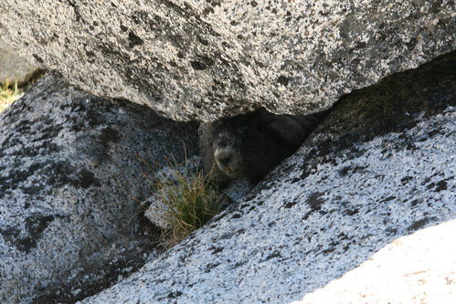
but overall, it was easy to get to, especially when compared to the day before. We wandered around the lakes up there, getting quite tan/burned at an elevation of 7800ft. There was a bit of wildlife, mostly marmots and pikas, and then we encountered this little guy who just sat and watched us for a good five minutes before we walked off:
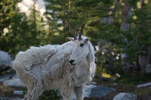
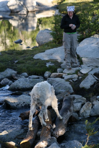
After getting back to camp, a mountain goat wandered through about five feet from our tent and stared at us for a while before wandering off.
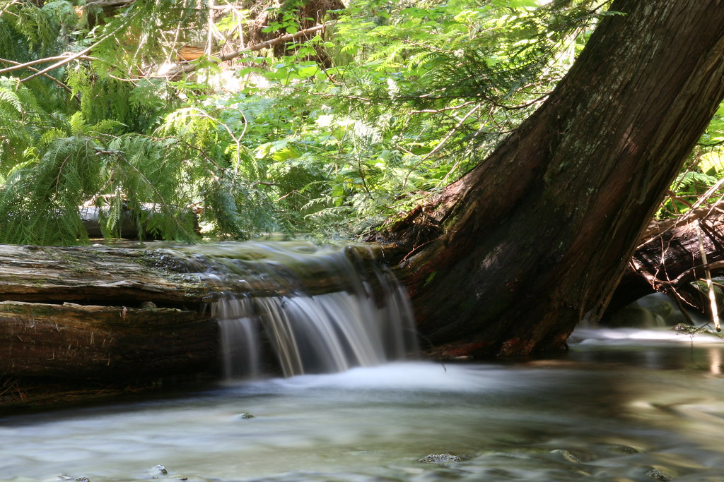
We returned that night and slept about as well as I can remember ever having slept, after taking a few semi-creative self-portraits:
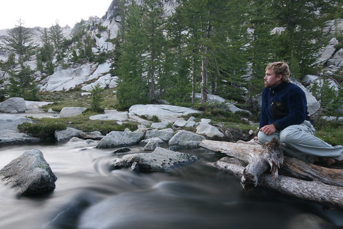
That was a 8-second exposure shot taken above the creek next to our campsite. The sky turned out overexposed (it was twilight) but I got the effect I wanted on the water. Hard to sit still for that long but I think I did an okay job.
The first night the winds were blowing through at 35-40MPH at times, which made for a restless night, especially when combined with how sore I already was. Night #2 was much more relaxing, though. Fell asleep before sunset and got up to explore on my own for day three as Kate hung around in camp and read.
thats the view from Prusik Pass, I think around 7500ft in elevation. The clouds moving in made for some dramatic skies in all directions. You can see, in the distance, Little Annapurna (its the triangular slope in the middle of the frame), which I wanted to climb, but didnt as I didnt bring my ice axe around and it was still a fairly snowy ascent.
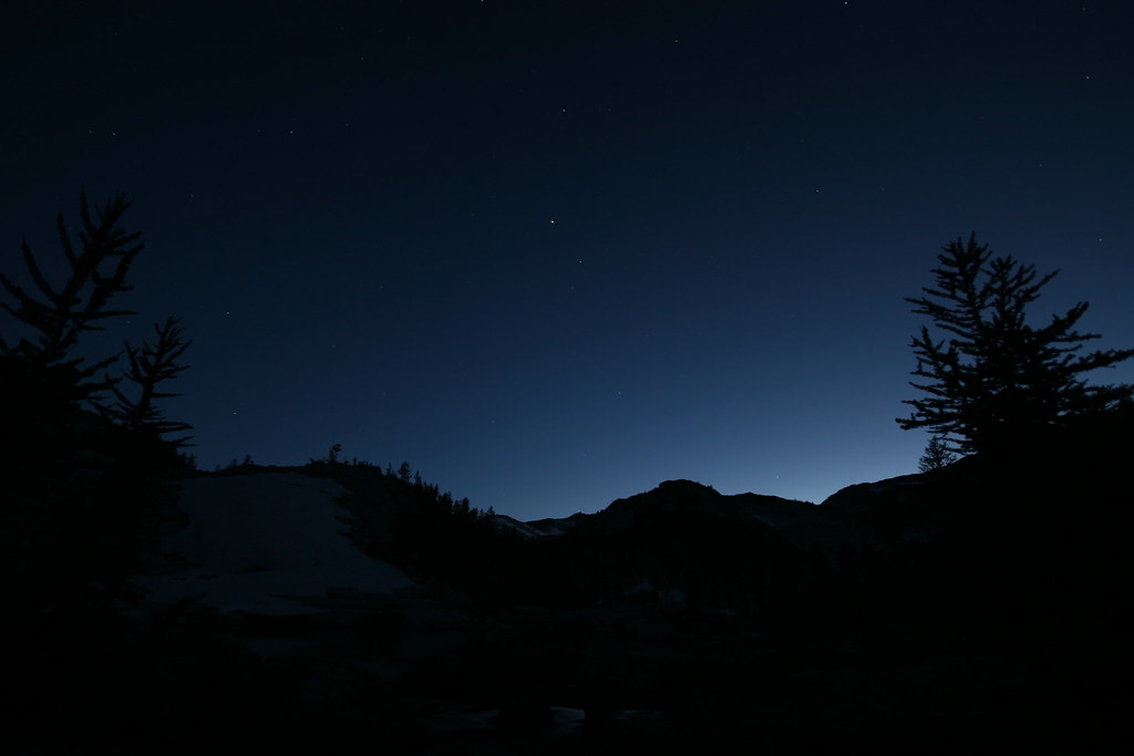
I came back that night to take my first-ever 30-second time lapse photo of a beautifulstarry sky, using a tripod called a
Gorillapod SLR Zoom, which wraps itself around rocks/trees/whatever and grips on quite tightly. Im actually very impressed with how well it works as a lightweight substitute for a tripod (overall with the tripod ballhead I think it weighs about 12oz).